My Land Tour of the Los Angeles River
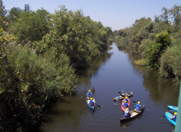
Summer paddling tour of the LA River in the Sepulveda Basin
Friends of the L.A. River is one of the groups involved
My Land Tour of the Los Angeles River
By Nancy Clark, (with contribution by Elaine Trogman)
Did you know that you can actually tour the Los Angeles River and impress your friends that think it's nothing more than concrete Flood Control Channels as depicted on some local maps? If not, then read on.
Our Los Angeles River flows over 50 miles from its San Fernando Valley headwaters in Canoga Park all the way to Long Beach Harbor. In the San Fernando Valley it starts out as an west/east river and turns at Glendale to run north and south to the ocean at Long Beach. The surrounding area was settled by the indigenous peoples of the Tongva/Gabrieleno and Chumash. In the 1700's, Spanish explorers were attracted to the beauty of the river, settling in what is now the City of Los Angeles. Over the years, the Los Angeles River was shaped and reshaped by storm waters and due to flooding, in the 1930's it was channelized and concreted to protect neighborhoods from future flooding.
More recently, there has been a growing effort to revitalize the Los Angeles River and long range plans are to revive the ecological heritage by removing the concrete in some areas, thus inviting the return of wildlife as well as attracting outdoor recreation. Imagine new parks, bicycle paths, walkways, terraces, green streets and artwork, all of which will encourage community gatherings and promote appreciation of the beauty of the area.
We are lucky to be chosen twice by the Obama administration for L.A. River revitalization as part of two programs, which are "America's Great Outdoors" and the "Urban Waters Federal Partnership." The intension is to make the L.A. River a great waterway, which includes work on some of its tributaries. In Compton they have created a 9-acre park named the South L.A. Wetlands Park from a former railcar maintenance yard. The wetlands plantings are small but in a few years they will treat storm water before it goes into the L.A. River. .
I had the pleasure to visit the Los Angeles River with "Hidden L.A" a couple years ago on three separate carpool tours covering the length of the river.
The All-Valley tour started at the Headwaters (near Canoga Park High School.) At The Great Wall of Los Angeles, near L.A. Valley College, we found a huge mural artfully depicting Los Angeles history.
Although I had heard talk of closure to traffic during times of flooding, I'd never been to the Sepulveda Basin or to the area north of the dam, which is a sandy bottomed area where we strolled along the banks and saw many kinds of birdlife. Now I have learned to recognize them. By the way, this was where Friends of the LA River (FOLAR) held the Paddle the LA River program in 2011. There is much interest in that happening again and I will be there when it does.
In 2008 the L.A. River expedition's canoes and kayaks navigated the full 51 miles of the river, which helped to give the L. A. River watershed the Clean Water Act protections. See website.
Representing the river's wildlife, art-lovers will not want to miss The Great Heron Gates at Rattlesnake Park. Another meeting place was the soft-bottomed Bette Davis Picnic Area (north tip of Griffith Park where Riverside, Victory and Sonora meet.) Still another with a natural appearance, Glendale Narrows and its Yoga Park is an example of an area that escaped being cemented-in due to the high water table. (Atwater Village to Cypress)
The idea of someday seeing the River come back to life, rather than carrying waste to the ocean, piqued my interest in taking the next two tours of the central and south portions a couple of Sundays later. The leader Jenny Price navigated us to several of the soft bottom areas that had a more river-like look.
Once called the Cornfield, the Los Angeles Historic Park is now a beautiful green space with trees, fountains and new plantings. This historic park has a visitor center and a museum with old River pictures.
A good leg-stretching opportunity was the 6th Street Bridge, which you will recognize from the many movies that were filmed there-for starters, think Grease and Terminator.
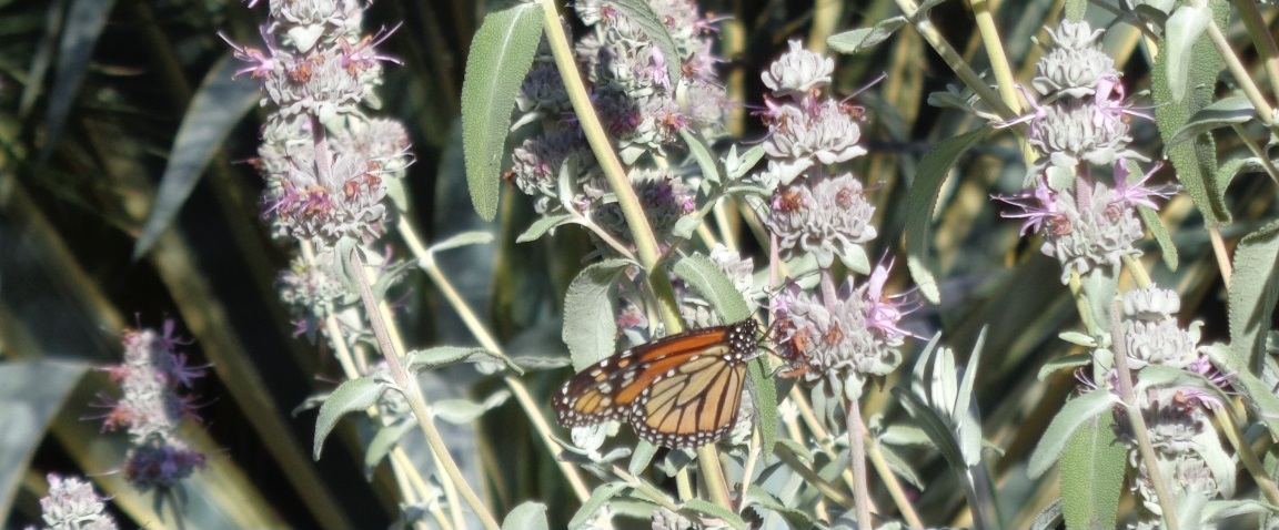
Compton Creek is a natural habitat area that is left to grow cattails through most of the year, but is bulldozed down when storm season approaches, leaving birds, rabbits, dragonflies and butterflies all fleeing in search of new homes. Dominguez Gap Wetlands opened in May 2008 and incorporates a filtering system of plants. Hikers have reported seeing herons, cranes, mallards, turtles, hummingbirds, falcons and the bright yellow False Lupine growing.
Closer to the mouth of the river at the ocean is Willow Street Estuary and Golden Shore Marine Biological Reserve in Long Beach (mouth of river).
With all this in our own back yard, I came away from each tour with an appreciation of what beauty already exists and am anxious to watch as the revitalization continues. For more information on the Los Angeles River, FOLAR, visit the Los Angeles River website or the Friends of the Los Angeles River website
.