Climb the highest mountain, but how high is Mt. Whitney?
The accepted elevation of Mt. Whitney, the highest peak in the contiguous U.S., has “changed” several times since it was first climbed in 1873. A quick Google search of “Mt. Whitney + Elevation” produces a height of 14,505 feet for the summit whose trailhead begins north of Lone Pine, Calif.
But then there’s the gift store that’s down to its last 14,497-foot Whitney T-shirts and shot glasses. All of the new shirts put the summit at 14,508 feet.
Though I’m a complete layman when it comes to cartography and surveying, I do understand that Mt. Whitney is not necessarily growing a couple of feet every year. So why are there so many different elevations on record for one mountain, especially such an iconic Sierra peak?
Many of Whitney’s elevation readjustments have occurred because more up-to-date methods of numerical interpretation have been developed since the peak was first officially measured by the Wheeler Survey more than 125 years ago.
In August, I called the United States Geological Survey (USGS) to confirm the correct elevation and was put in touch with Dale Benson, a cartographer in the USGS National Geospatial Technical Operations Center in Denver who provided a wealth of information about the history of Mt. Whitney's surveys and elevation.
A bit of Whitney history
The first recorded climb of Mt. Whitney occurred in 1873 when three fishermen — Charles Begole, Albert Johnson and John Lucas —reached the summit from the town of Lone Pine. Shortly thereafter, Whitney Survey party member Clarence King, who initially climbed nearby Mt. Langley thinking it was higher, also reached the top of Whitney.
Over the years, various survey parties have gone to great lengths to measure the elevation of Mt. Whitney, each placing a marker noting their calculations on the summit. The earliest was most likely a station mark, consisting of rock cairn placed by the Wheeler Survey.
In March 2005, John Sellars, cartographic technician at the USGS Rocky Mountain Mapping Center in Denver, compiled an excellent history of surveys and establishment of elevations on Mt. Whitney of which there are many.
 Sellars wrote that in 1905, the USGS ran a level line to the summit of Mt. Whitney, to the highest point, setting a tablet labeled "14502" feet for the elevation 14501.976. The elevation was readjusted in the notes of the level man, R.A. Farmer, to 14500.695 feet. A "special tablet" was described in USGS Bulletins 342 and 766. The USGS Survey Bulletin 310, Results of Primary Triangulation and Primary Traverse, Fiscal Year 1905-06, noted the station mark as a "triangulation tablet cemented in rock under an 8-foot high cairn at an elevation of 14499 ft. above mean sea level."
Additional level lines were run by the U.S. Coast & Geodetic Survey (abbreviated C&GS; later renamed the National Geodetic Survey) in 1925 and 1928, establishing a new elevation on top of the 1905 USGS tablet, as well setting two additional marks on the top of the mountain—BM U43 1925 and BM K72 1928.
The National Park Service placed the following plaque: “Mount Whitney Elevation 14,496.811 feet. John Muir Trail-High Sierra September 5, 1930.”
Six other marks were in place prior to the 1950 C&GS tablet being set. Sellars noted that the National Geodetic Survey (NGS) triangulation station "Whitney 1950" was the mark recognized by the USGS with the highest degree of horizontal accuracy.
Because of this, the elevation shown on the 7.5' quadrangle map published in 1994 was 14,491 feet – and this is where it gets rather technical. That number is the NGVD29 (National Geodetic Vertical Datum of 1929) elevation for the NGS 1950 station. The USGS benchmark has an NGVD29 elevation of 14,494 feet, but the depiction of this was superseded by the NGS mark having a better horizontal position.
And the true elevation is...?
Sellars concluded that the elevation for Mt. Whitney using the North American Vertical Datum of 1988 (NAVD88) should be 14500.24 feet based on using the NGS program VERTCON to convert the elevation of 14494.12 feet (NGVD29) derived from the elevation differences of the "14502" and "Whitney 1950" marks as described in the 1950 and 1962 C&GS descriptions
In 2005, an article by Guy Rocha, an archivist for the State of Nevada, titled “Height of a Mountain Tale” was published in the Nevada Observer. Rocha introduces surveyor Robert Nielsen, who in 1996, as student at California State University Fresno, led a survey party to determine whether or not White Mountain Peak was taller than Mount Whitney.
Rocha writes: "As a student in the Surveying Engineering Program, Nielsen and his colleagues organized four summit crews to climb the four highest peaks in California: Mt. Whitney, Mt. Williamson, White Mountain, and North Palisade. ‘Our goal,’ wrote Nielsen, 'was to take simultaneous GPS observations from the tops of four, 14,000’-plus mountains, my high elevation test base'."
They determined that Mt. Whitney at 14,500 ft. was the highest mountain in the contiguous United States followed by Mt. Williamson, 14,382.3 ft.; North Palisade, 14,255.9 ft.; and White Mountain, 14,243.2 ft., now the 22nd highest peak in the contiguous U.S.
Rocha concludes: "With further GPS surveys of mountain summits in the Rocky Mountains, White Mountain's rank may change again."
The following description by Dale Benson shared with several colleagues, including William Stone, Geodetic Advisor with NOAA’s National Geodetic Survey Southwest Region, best explains the findings that justify 14,500 ft. elevation in a very technical manner:
"14505 is the published NAVD88 elevation for the National Geodetic Survey trig station at the top. That elevation is a VERTCON conversion of the old Vertical Angle elevation (14498 feet) from the C&GS occupation in 1950 (PID GT1811). When USGS was up there in 1956, they transferred an elevation from the NGS BM U43. Also, the 1950 and 1962 descriptions of Whitney give differences of elevations to several other stations on the top that indicate they are higher than the National Geodetic Survey trig station.
Translation? The 14,505 foot measurement relied on old data.
 “Using the transferred elevation to the National Geodetic Survey station Whitney, and applying the differences listed in the description would indicate the highest point is the USGS mark 14502 or the USGS 'special tablet' which appeared to have been set over it and later destroyed. In either case, the rounded NAVD88 elevation for the highest point would be 14500.3 ft., or 14,500 ft. for ease of communication."
NOAA/NGS geodetic advisor William Stone agreed with Benson’s calculations. Based on the data available to date, the elevation of Mt. Whitney is actually 14,500 feet., not 14,505 feet.
No matter how high, it's still a feat
What does this mean for Mt. Whitney? As technology improves, there may be additional elevation readjustments not only on Mt. Whitney but other mountains as well.
For most people, hiking to the summit of Mt. Whitney, approximately 6,000 feet of elevation gain and 22 miles by the easiest non-technical route, is a lifetime accomplishment.
As one Santa Monica hiker who summited Mt. Whitney a few years ago said when learning of the most recent elevation change, “I have a coffee mug that states 14,497.61' and a T-Shirt that states "I Climbed (big letters) out of my car to take a picture of (tiny letters) Mt. Whitney, CA (Big), plus 14,497'. I stand by my coffee mug and T-Shirt as the defining elevation!”
Wynne Benti is coauthor of the book, Climbing Mt. Whitney and publisher at Spotted Dog Press in Bishop, California.
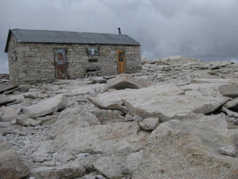
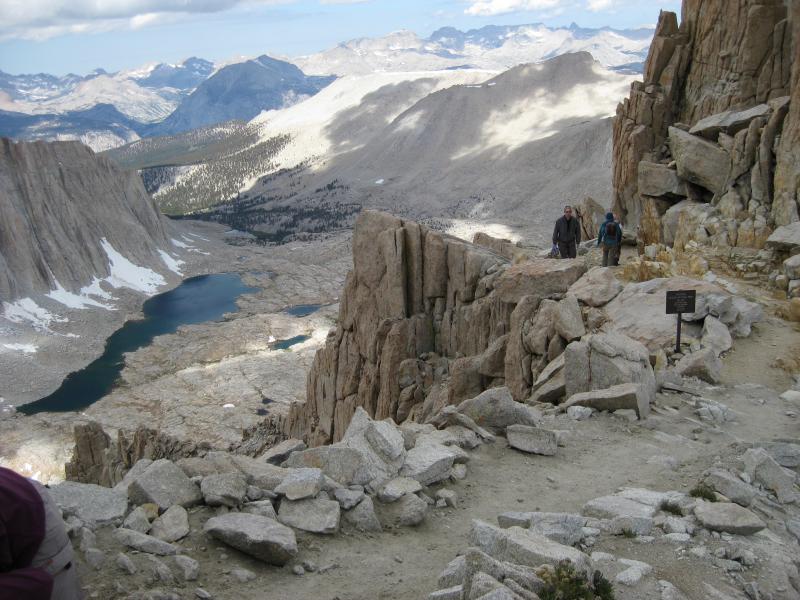
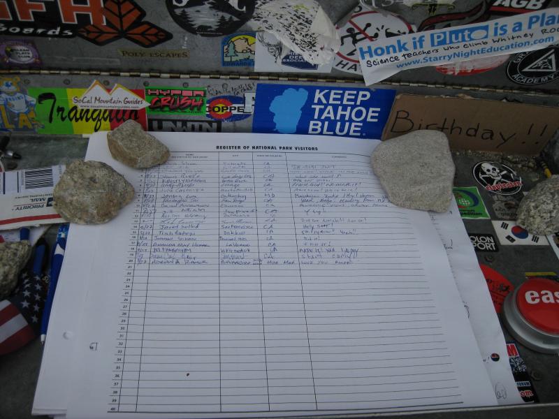
Photos: From top, the summit of Mt. Whitney; the view from Trail Crest and the sign-in book at the top. Credit: Mary Forgione

Comments
Mike Bartling (not verified)
October 2, 2013 - 4:57am
Permalink
The true height of Mt. Whitney
Mike Bartling (not verified)
October 2, 2013 - 5:24pm
Permalink
Height of Mt. Whitney
Mike Barting (not verified)
October 3, 2013 - 9:09am
Permalink
True height of Mt. Whitney
Will Tate (not verified)
August 9, 2020 - 5:54pm
Permalink
The true height is not important.
Add new comment