A trans-Sierra trek reveals beauty and friendship

My car was 22 miles away, so I started walking.
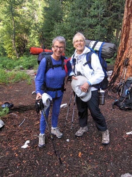
My buddy, Blanch Kosche, joined me. We hoisted our backpacks onto our osteoporotic hips (I’m 68 and Blanch is 72) and walked three days, from the east (near Independence) to the west (in Kings Canyon National Park) across the rugged spine of California. The Trans Sierra Traverse, as I named it, was like passing through a display rack of picture postcards of stunning rocks, trees, lakes and mountains. A walk across our beautiful state is a real-life geology illustration.

The major challenge of a one-way trip is, how do you get home? The answer is to arrange two teams, TST East and TST West, hiking the same trails in opposite directions. We would meet at a pre-determined creek crossing in the middle and with great ceremony do a car key exchange, a version of the Transcontinental Railroad’s Golden Spike.
A car key exchange is a sacred commitment upon the part of a hiking pal, in this case Hugh Warren, that he will drive my car to the trailhead parking lot where our trip ends and leave it there, full of gas. I would do the same for him. Hugh and I had shared a sacred handshake / pinky finger salute that no matter what the circumstances, including rain (more on that later), nausea, or a whining party
 member who “wanted to go out,” the car would stay put. To emerge from a major trip with food eaten, water drunk, and no transportation out of the wilderness would be serious business.
Hugh and I bear-proofed both cars by thorough interior vacuuming, and we promised that we would not eat in each other’s cars on the long drive from our Ventura county homes to the trailheads. By the way, you can also reverse your route by public transportation, if you have another two or three days to spare. My buddy, Jacquie Kaner, who couldn’t do the hike at the last minute because her back went out, rode six buses, walked and hitch-hiked with some “very interesting people” to meet us. Pretty brave for a 68 year old woman with only a Swiss Army knife for protection.
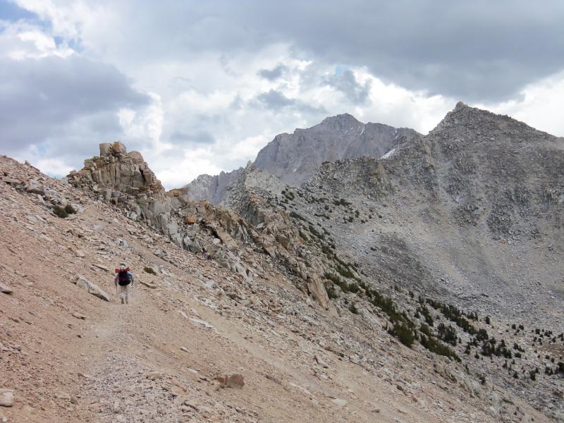
Each day’s scenery was completely different. Day 1 was Dry Rock Day. We left Onion Valley trailhead at 9,185 feet and climbed 2,400 feet into those stunning rocks you see from Highway 395. The terrain was steep, dry and breathtaking. Even though the area was desolate with little green, there were a few small lakes. How does the water get there? Snow melt? Note to self: must ask geologist.
Access to fresh water was a worry on this trip, and the lakes were a comfort. One slight problem: although the lake was only one contour line away on a map, it was a 100 foot drop through rugged scree to get to the water. We simply could not run out of water in hot, dry country, because that means muscle cramps and possible heat exhaustion. So we ended up carrying far more water than we needed simply to be cautious.

Day 2 was Alpine Lakes Day. I have hiked all over the world, and what we saw near the John Muir Trail and in Kearsarge meadows was as spectacular as anything I’ve ever seen. A series of lakes just sparkled in the sun. The meadows were open, with lots of evergreens and inviting nooks and crannies. The ground was a series of flat tables that nature offered at different elevations, so we could pitch a tent just out of sight of the group below us. The high mountains ringed the area like sentinels. I didn’t take pictures; just looked and looked and looked, burning the beauty into my brain. This area was what made the trip so special. A typical hiker can walk in 5 miles, look around, and return the same route in a day. But to pierce 10 or 15 miles into the deeper wilderness is too much for most people. This is one reason people love to backpack; it is the only way many remote areas are accessible.
Day 3 was the Green Zone. Now we were dropping into the west side towards King Canyon and Sequoia national parks, which get more rain. Everything was green from the trees
to the brushy ground cover. Many creeks and rivers. Lots of ferns. It was Blanch who pointed out that ferns come with rain, and just then, rain it did. The rain was not forecast. It was simply the result of the hundred-degree heat of eastern California colliding with the cooler air of the higher elevations. We thought the first drops signaled just a sprinkle. The sprinkle continued. We decided to tuck our packs under over-hanging rocks for a half hour or so. The big focus in a rainstorm is to Keep the Sleeping Bags Dry. Down sleeping bags are by far the lightest weight to carry and the warmest, but when wet they are useless.

The rain let up and we kept on hustling to our planned camp. Just as we walked in, the torrents began. We set up our tent in record time and dived in. Then we spent the next three hours marveling at the sheets of water coming down, mopping puddles, and counting the timebetween lightning flashes and thunder crashes. Mother Nature at work. Wow. After the rain we went to get drinking water and discovered thecreek was full of sediment and a foot higher than when we set up camp. Nothing to do but put the water in bottles and let the debris settle to the
bottom. Then, much like fine wine, decant.
Finally we hiked out in long johns, our only dry clothes, and arrived at our waiting car that was parked atRoads End where Hugh had promised. We drove steadily back into the mundane, leaving the secrets of the Sierra behind.
Lynn Lively is a Sierra Club leader and free-lance travel writer.
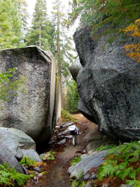
Photos by Blanch Kosche. From top: Heading down the trail after cresting 11,760-foot Kearsarge Pass. Lynn Lively, left, and Blanch Kosche set off on a 22-mile adventure to cross the Sierra from east to west. Boulders and ferns frame the trail down to Charlotte Creek. Hugh Warren and Lynn Lively make the critical car key exchange during the trans-Sierra trek.


Comments
Lynn Bossone (not verified)
January 4, 2013 - 5:46pm
Permalink
the trek
Willie Walker (not verified)
January 5, 2013 - 5:09am
Permalink
Thanks for the memories
Craig Houx (not verified)
January 5, 2013 - 10:24am
Permalink
Trans Sierra Traverse
Bethany Freeman (not verified)
January 5, 2013 - 1:16pm
Permalink
Thanks for sharing this!
Jackie Barton (not verified)
January 7, 2013 - 5:57pm
Permalink
Lynn's hike
Beth Martin (not verified)
March 4, 2013 - 10:17am
Permalink
Great story!
Add new comment